Weather and photography, what a great combination of interests to have on a day when you can bring the two together. Today was just one of those days. Ok, so I am totally aware of all things Meteorological, with a lifetime interest in the weather and having spent several years employed by the BOM, initially trained as a weather observer. Then add to the mix a passion for photography and hey, I’m in my element on a day like this. This is how I enjoyed the afternoon and the event that unfolded.
With strong northerly winds for most of the day, the temperature reaches a pleasant 20 degrees, one of the warmest days for many weeks. Blue skies start to be invaded from the west early in the afternoon as a strong cold front approaches Melbourne. A check on the weather radar shows that it has passed through the western coastal parts of the state and temperatures there have fallen to around 9 degrees.
A sharp line of rain associated with the squall line appears to be rapidly heading towards the city and the advancing front is likely to create a spectacular view across Port Phillip Bay. So that means just one thing, time to grab the camera and head for the beach at Black Rock (where I grew up) for the best vantage point.

Blue skies start to turn grey in the north-west

The front progressively advances towards Melbourne

The sky darkens and the temperature begins to fall
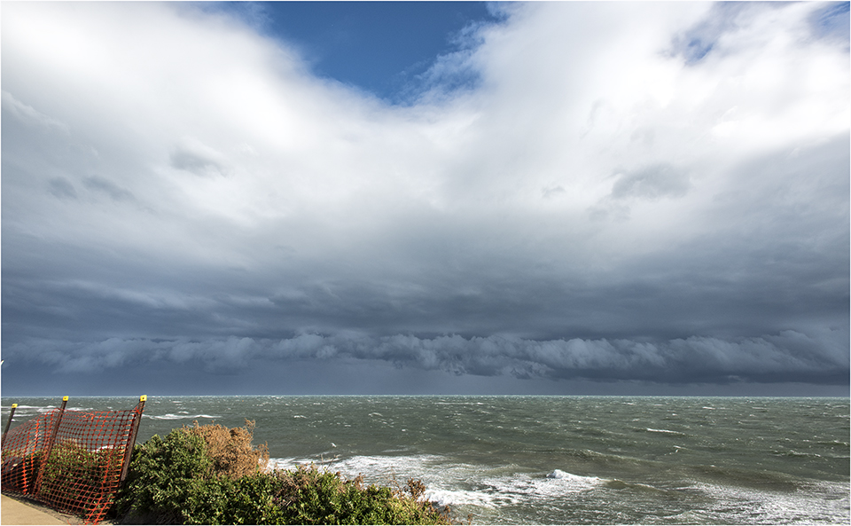
The light starts to fail as the cloud advances. Still the strong northerly winds continue to buffet the coast and holding the camera steady becomes even more difficult in the conditions. Fortunately the direction of the wind is such that the local promenade and bluestone retaining wall escape damage on this occasion. The storm that struck the area more recently heralded damaging winds from the west and some of the temporary orange fencing closing off the area to the public can be seen in the image below.
The view from the south-west
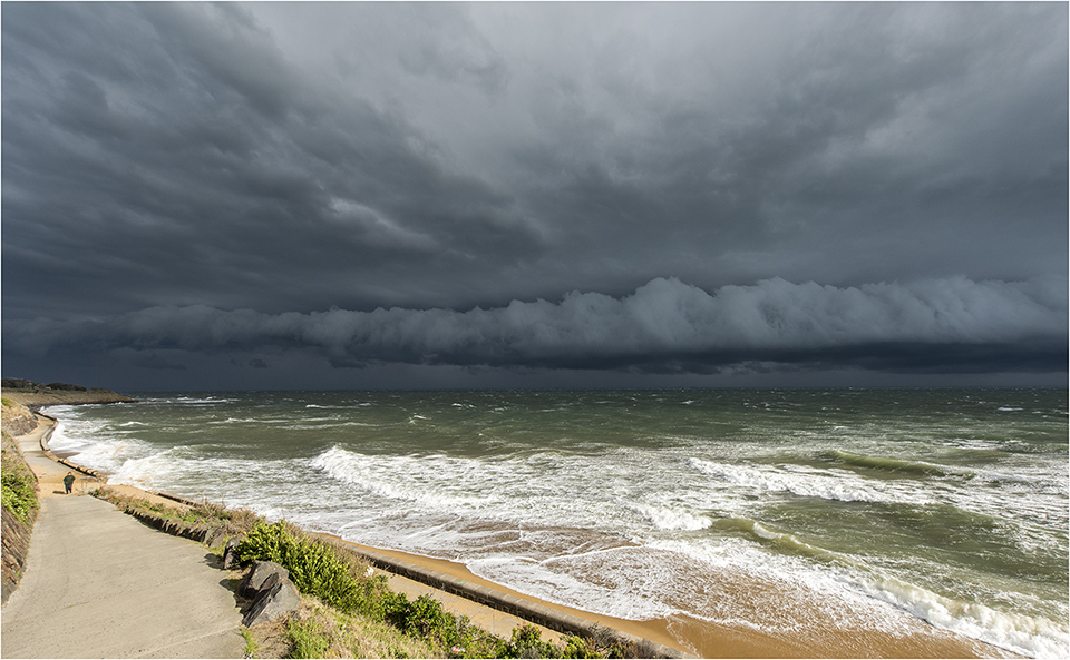
One local resident takes a stroll oblivious to the weather event

Roll cloud associated with storm front gets darker and darker
As the front passes through the chill of the fresh south-westerly wind can be felt and the temperature rapidly drops by about 10 degrees, heavy rain begins to fall so its time to put the camera away and head for home. Another spectacular performance by Mother Nature. Other than one or two curious onlookers most people missed the show that was there for all to see. But of course they will be turning on the TV to see the evening news unaware that they could have watched it in person and the tickets were free.

A distinct flat base forms as the dark line of the wind squall begins to appear on the horizon
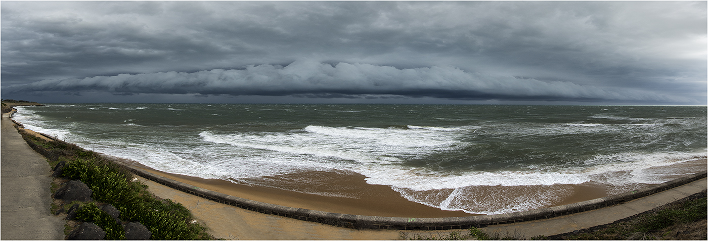
180 degree panoramic view of the storm front
